Mapping Amache
A companion page to the online maps of Amache – listed in the sidebar >>
The entries below are intended to help visitors to the online maps make full use of them. A slightly longer description of this site and the corresponding maps is on the About page. Feel free to contribute feedback or questions on the Contact page. This is in support of the D.U. Amache Research Project and Friends of Amache / Amache.org.
Amache From Above
See views of Amache from above on this page
Navigating around the map
Using the Amache Camp Directory Map
 Navigation tools are in the upper left hand area.
The plus (+) and minus (-) are to zoom in and zoom out.
The Home button will zoom to the full extent of the map.
The arrows pointing to the right and left will go to the previous map extent.
On the map itself, double click anywhere to zoom to that place.
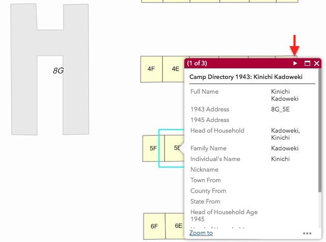
(See below) When you zoom in and individual barrack units become visible, you can see who lived there by clicking ONCE on the unit. A pop-up info bubble should appear with a brief set of information about that individual.
Below, unit 8G_5E has been selected (single click). At the top of the pop-up window, we can see that record 1 of 3 is being displayed. Go to the next record by using the triangle shaped button (see arrow) at the top right. This will show all records from 1943 and 1945 for that unit.
There is a ‘Zoom to’ button at the bottom left in case you want to zoom in closer to that barrack unit. On the bottom right are the (…) three dots. Click there to see the records in the attribute table for easier reading.
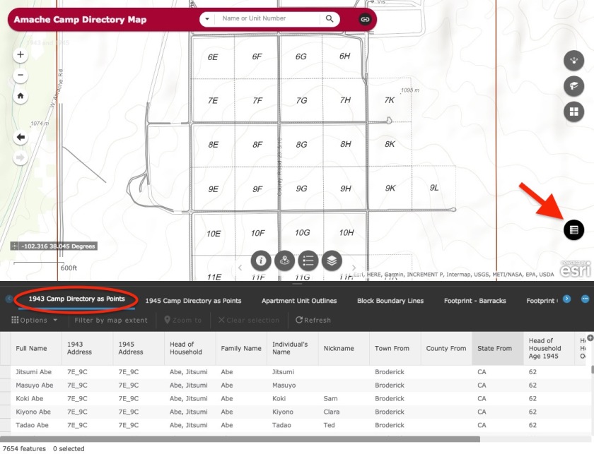
Find people using the Attribute Table widget
All of the Amache internees listed in the 1943 and 1945 directories used for this map are listed in the attached tables. Browse or search these tables by using the Attribute Table widget located in the lower right hand corner of the page
 .
.
This will open a panel at the bottom of the page, displaying tables for several map layers. Here, you can search for people by name or location and easily see all of the information available for these individuals.
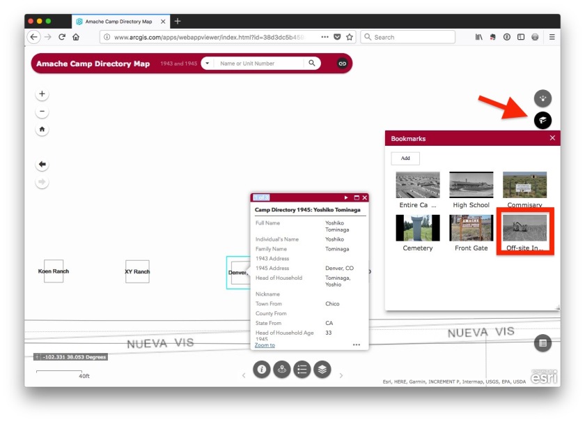
Amache off-site internees bookmark
Some of those interned at Amache managed to find work, educational or other opportunities outside the barbed wire of the camp. These individuals were listed in the Amache directories in 1943 and 1945, but were shown as living in other locations. These were nearby places such as the XY Ranch and more distant places such as Minneapolis, MN. In order to represent these individuals, several “places” have been created on the map to show the various places where they lived during the period of incarceration. (see below)
These off-site locations are shown on the map just above blocks 6E and 6F as pictured below. There is a bookmark in the Bookmarks panel on the right hand side with a link called Off-site internees. Click on the location markers and notice the many individuals who were registered as Amache internees but moved on to other places.
Also, try out the other bookmarks to quickly navigate to other bookmarked places on the map.
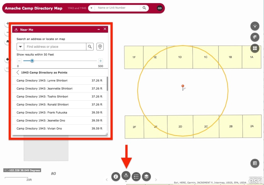
Using the Near Me widget to find people
The Near Me widget  is at the bottom of the Amache Camp Directory Map.
It shows people listed as living within a certain distance of a chosen point. The widget starts at 50 feet and displays everybody listed from 1943 and 1945 within that area. The size of the area can be changed, or the location can be re-selected. It can be useful to see who lived near a certain place within Amache.
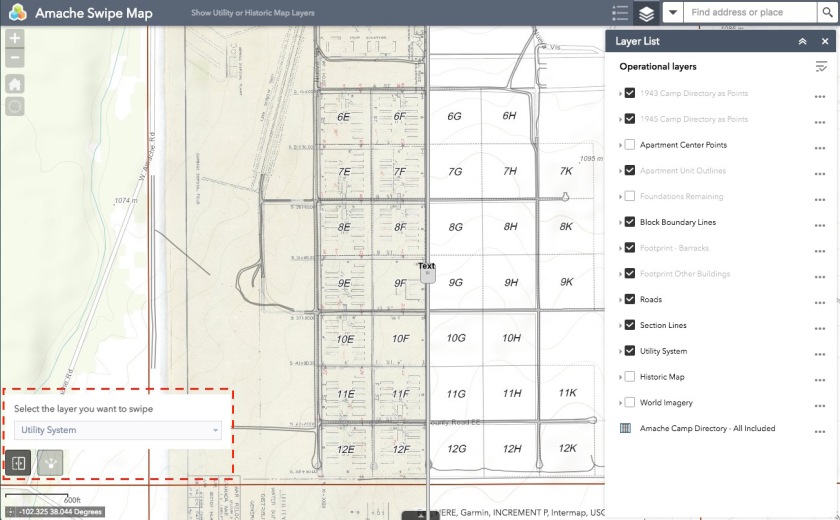
Swipe Map of Amache
This separate map underlays two maps which display the original camp layout as drawn, and the utility system as planned for Amache. Use the link below to visit this map. It is separate from the Amache Camp Directory Map to prevent too many features and buttons from being on the same page.
The Swipe Tool is turned on by default at the bottom left. Using the Layer List panel on the right, switch on and off the Utility System , Historic Map and the World Imagery layers. Swipe the divider tool back and forth to show or hide the layers.
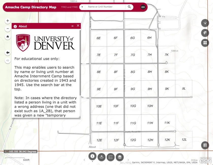
Amache Web Map and Directory Search
Searchable Amache Map
I’ve developed a web app which includes a map of Amache as well as the ability to search the camp directory from either 1943 or 1945. Use the search bar at the top to enter names or barrack address (ex: 7G_5F). Have a look and see if you can find the person you’re looking for. This was done using ArcGIS Online and is hosted by the University of Denver.
Link to the Amache Camp Directory Map:
http://arcg.is/1Oae1f
Mapping Amache – Here We Go!
I have been mapping Amache Internment Camp since 2010… The challenge is to present this information in a way that makes it useful, accessible and honors the people who lived there.
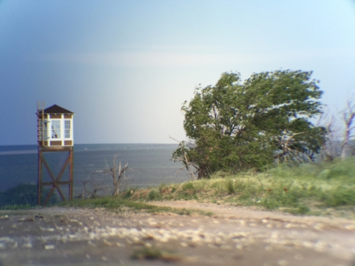
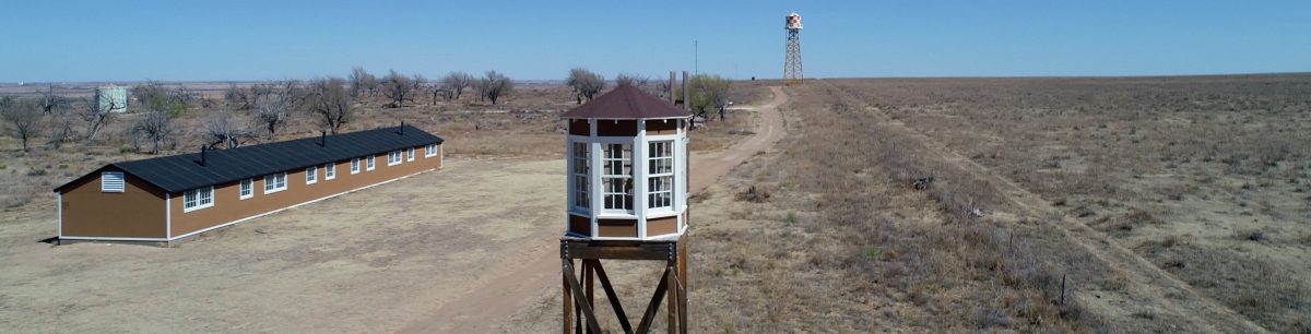
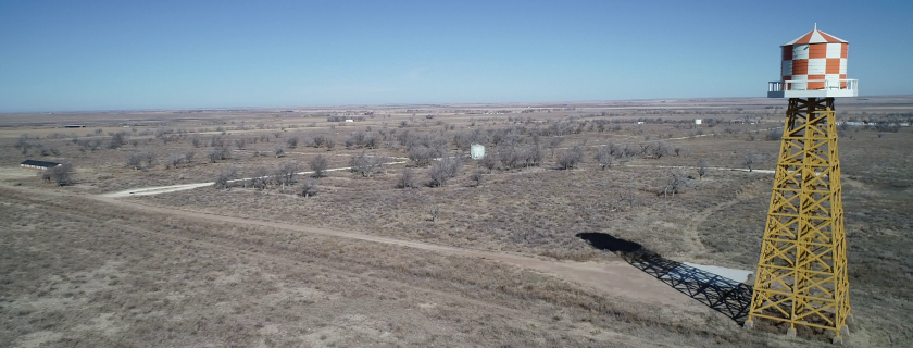
Amache Internment Camp is located near Granada, Colorado. It is where over 10,000 Japanese-American citizens and persons of Japanese ancestry were forced to live from 1942-1945. It is also called Granada Relocation Center.
I have been mapping Amache Internment Camp since 2010 as a GIS specialist for the University of Denver Department of Anthropology. It is my good fortune to be working on this project still.
This weblog is intended to follow along with the long-term project of mapping this one square mile of earth where so much history took place. The basic map of Amache has been developed over the last few years. There are layers for things like roads, boundary, housing blocks, barracks and so forth. The challenge is to present this information in a way that makes it useful, accessible and honors the people who lived there.