Swipe Map of Amache

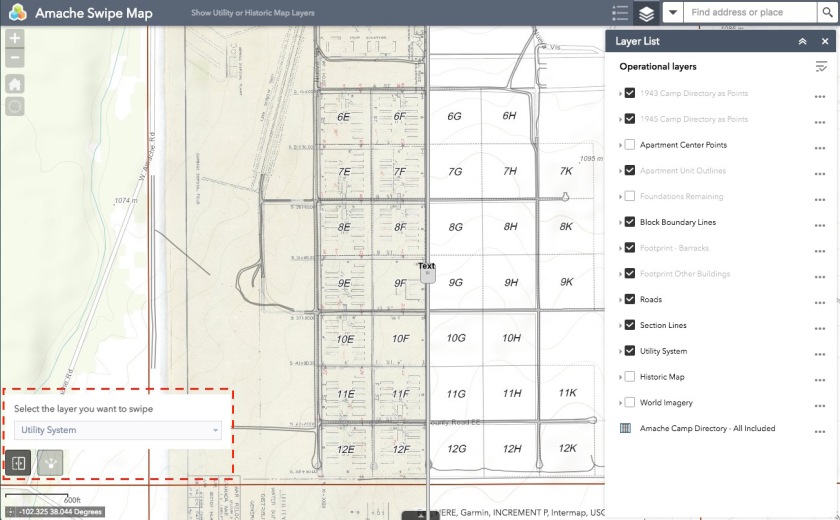
This separate map underlays two maps which display the original camp layout as drawn, and the utility system as planned for Amache.  Use the link below to visit this map. It is separate from the Amache Camp Directory Map to prevent too many features and buttons from being on the same page.

The Swipe Tool is turned on by default at the bottom left. Using the Layer List panel on the right, switch on and off the Utility System , Historic Map and the World Imagery layers. Swipe the divider tool back and forth to show or hide the layers.

http://arcg.is/1aCO91

swipe tool large

Amache Web Map and Directory Search

Searchable Amache Map

I’ve developed a web app which includes a map of Amache as well as the ability to search the camp directory from either 1943 or 1945. Use the search bar at the top to enter names or barrack address (ex: 7G_5F).  Have a look and see if you can find the person you’re looking for. This was done using ArcGIS Online and is hosted by the University of Denver.

Link to the Amache Camp Directory Map:
http://arcg.is/1Oae1f

Screen Shot 2018-01-14 at 9.24.34 PM